
Hello
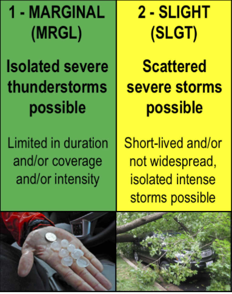
Today is on the “Slight Side” of severe weather. As best as we try, I feel images are best shared and universally understood. So, this is what “Slight” looks like when you see it (also the green explains the image above).
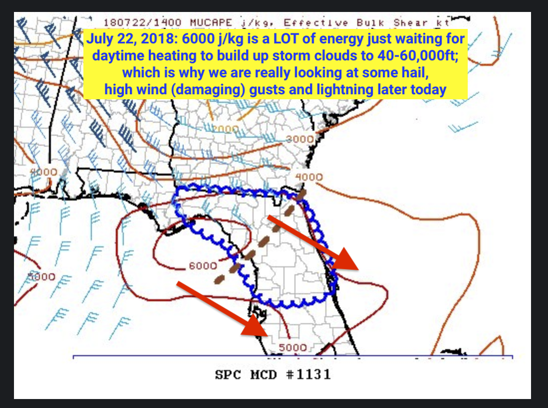
I thought I would give you some geek speak, then keep it solvent for my wife.
She hates it when I go “weather geek”. (Insert Smiley)
What to expect:
“Wind gusts in excess of 60 mph are possible in the strongest storms, which can cause tree branches and leaves to litter the ground, as well as downing mature trees and power lines.
Downpours can lead to localized flash flooding and create hazards for motorists by reducing visibility and heightening the risk of hydroplaning when traveling at highway speeds.
It is not out of the question for there to be an isolated tornado. While an outbreak is not expected, it only takes a single tornado on a given day to devastate a community.
Some of the cities at risk for potentially violent and drenching storms include Savannah, Georgia; Jacksonville, Tallahassee, Ocala and Orlando, Florida; and Charleston, South Carolina.
Those out hiking, golfing, fishing or boating should keep a watchful eye to the sky and make sure cell phones are on and fully charged with severe weather alerts enabled.” –http://bit.ly/July22SevereWeather
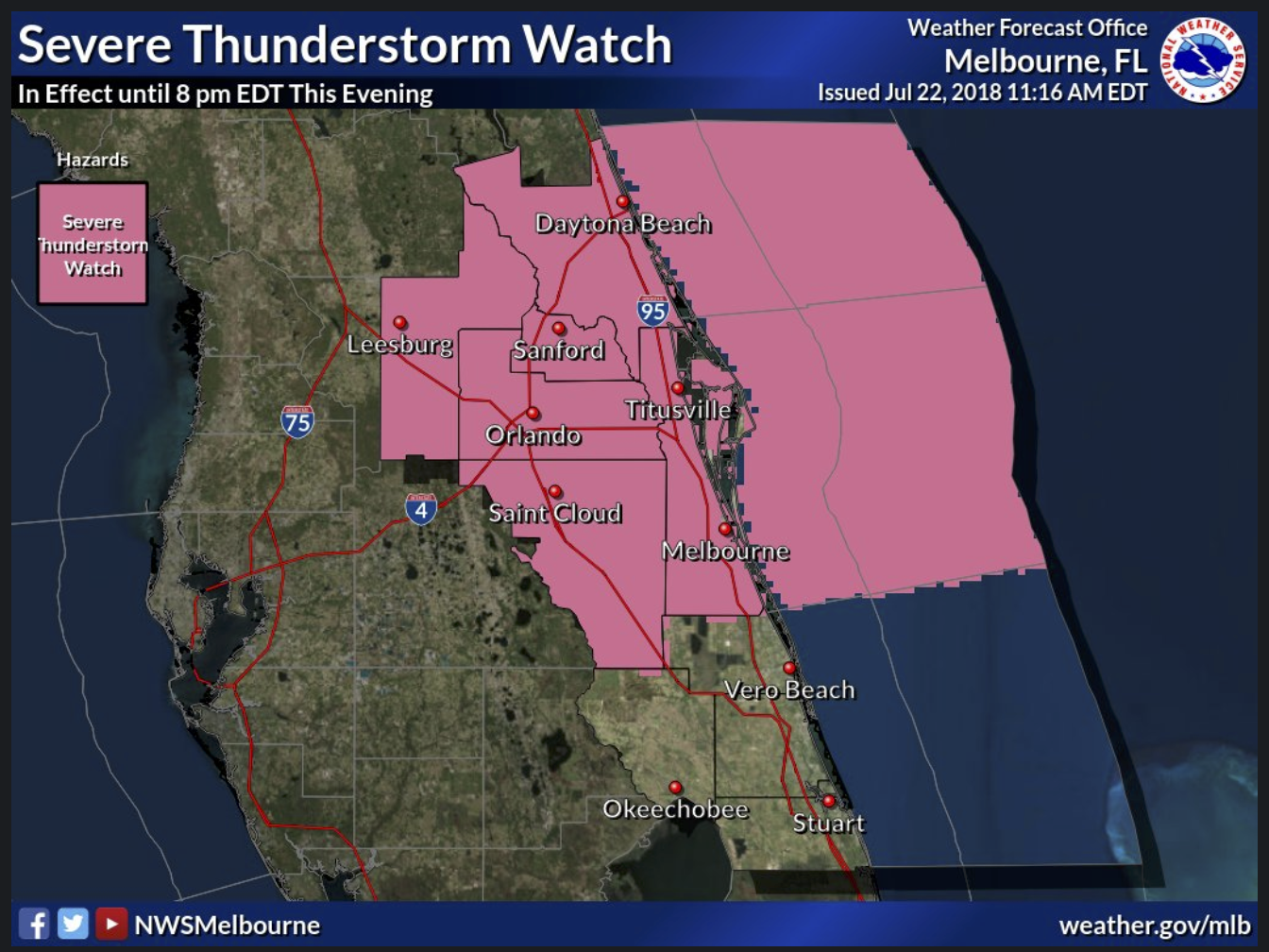

Be safe, and follow @Eric_Wilson7 on twitter for quick tornado updates; its really the fastest way to warn until…my app is up and ready within the coming weeks. Thanks for sharing ericwilsonweathersource.com with all those you love and care about in Central Florida today (July 22nd).
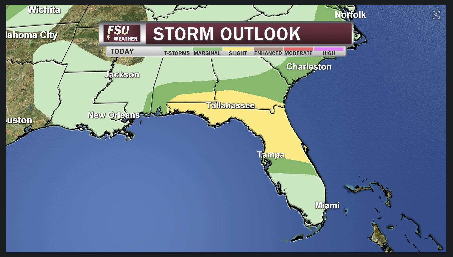
There is a slight risk for severe weather today across much of north Florida, including the Big Bend region. Risk includes damaging winds and hail, with a lower risk level for tornadoes. Remain weather aware and safe into the afternoon. #FLwx
My best, always.
Eric