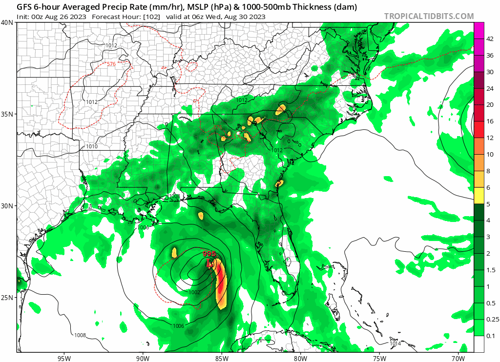
As Invest 93L builds, it is heading north into the Gulf of Mexico
Northwestern Caribbean Sea and Eastern Gulf of Mexico (AL93):
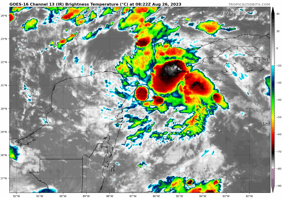
Shower and thunderstorm activity continues to show signs of
organization in association with an area of low pressure over the
northwestern Caribbean Sea. Environmental conditions appear
conducive for further development of this system during the next
several days, and a tropical depression is likely to form late this
weekend or early next week while it moves generally northward over
the eastern Gulf of Mexico.
Interests in the Yucatan Peninsula of
Mexico, western Cuba, and Florida should monitor the progress of
this system.
* Formation chance through 48 hours...medium...60 percent.
* Formation chance through 7 days...high...90 percent.
This is the time of year, as we approach the apex of Atlantic Hurricane Season (Mid September).
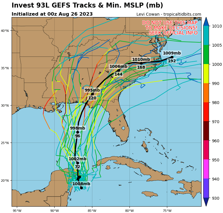
Keep in mind, never trust any solution beyond 48 hours; that said here are the details as we know them this morning (Saturday, Aug. 26th)
Trend for location for the last two model runs. Valid solution for Tuesday night, August 29th
This solution has been rather consistent over the last two model runs; often they differ beyond 48 hours, yet in this case they don’t.
Therefore, I’m keeping an eye on the development of this storm.
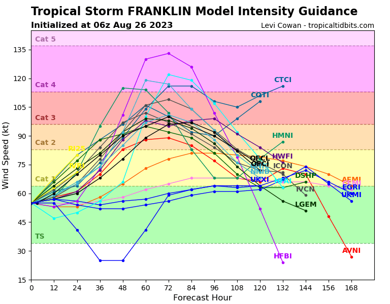
It’s also going to be strong, with Cat 3 projections by Tuesday. Yet I still caution that I have less than 30% confidence in the ‘exact-ness’ of this solution at this time.